 [Photos courtesy of City of Salem/Facebook]
 November 16, 2017 Episode.
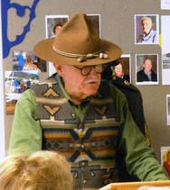
The City of Salem's Historic Preservation Plan outlines the efforts that will be taken to preserve and manage Salem's historic resources, both recognized and newly discovered, above ground and below. Quite a charge, wouldn't you say? Good thing Salem has an extremely competent, knowledgeable, and personable professional leading the program, our frequent guest Kimberli Fitzgerald, Historic Preservation Officer. Kimberli gets personally involved with each project, sometimes up to her boot-tops in mud.
The City of Salem's Historic Preservation Plan outlines the efforts that will be taken to preserve and manage Salem's historic resources, both recognized and newly discovered, above ground and below. Quite a charge, wouldn't you say? Good thing Salem has an extremely competent, knowledgeable, and personable professional leading the program, our frequent guest Kimberli Fitzgerald, Historic Preservation Officer. Kimberli gets personally involved with each project, sometimes up to her boot-tops in mud.
The State Historic Preservation Office maintains a database of statewide documented archeological sites in order to preserve them. However, only a licensed archaeologist can access them--general public access to the records could jeopardize the sites by publishing locations. Both private property owners and public agency staff occasionally disturb or discover such sites inadvertently, so having an archaeologist on the City's staff to review projects prior to excavating would certainly be a benefit. To that end, Kimberli has been pursuing a degree in archaeology focusing on public interpretation.
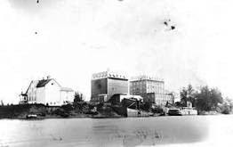 Capitol Mills (left) and Scotch Mills on east bank of Willamette River c 1880 (SPL Historic Photo Coll.) 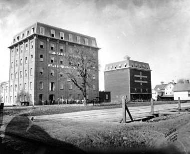 Scotch Mills, c1900, used for storage until fire in 1904 (SPL) | Public Works staff experienced an inadvertent discovery recently while working on a joint project with the Portland & West Railroad to improve the track crossings on a portion of Front Street. During excavation to lift the tracks, workers found a portion of the Division Street wooden millrace that was thought to have been filled over in the 1920s. The millrace was originally diverted to provide hydropower for the 1878 Scotch Mills on the east bank of the Willamette River. The mill was also known as the Capitol Mills and the Willamette Valley Flouring Mills before being destroyed by a fire of suspicious origin in 1904. Kimberli, SHPO, and PW staff thoroughly documented the site. An engineered apparatus was installed to preserve the site, and the street project was able to continue with only a short delay. Click here to read the whole report, minus the specific location details. |
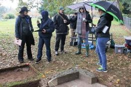
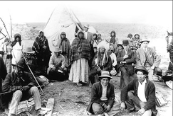
A culmination of Kimberli's study program is a public archaeology project in partnership with Willamette University and Pioneer Cemetery to document a Chinese shrine on the cemetery grounds. Chinese immigrants came to the Willamette Valley throughout the latter part of the 1880s. Records show they had businesses, homes, and a school. By 1903, Salem’s Chinatown was a half block of rundown buildings, and the Salem City Council ordered the entire area burned to the ground. A Chinese Shrine in Salem Pioneer Cemetery may be the last remnant of Chinese American’s presence in Salem.
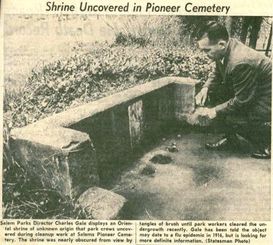
Identifying and interpreting this historic place is an important part of preserving Salem’s history, work that began as early as March 1963, according to a Statesman Journal newspaper article pictured above, right. Capi Lynn of the Statesman Journal recently wrote another article describing the new project. Here are a few pictures of the opening day of the Public Archeology Project you might enjoy. You can find even more pictures on the City's Facebook page.
Identifying and interpreting this historic place is an important part of preserving Salem’s history, work that began as early as March 1963, according to a Statesman Journal newspaper article pictured above, right. Capi Lynn of the Statesman Journal recently wrote another article describing the new project. Here are a few pictures of the opening day of the Public Archeology Project you might enjoy. You can find even more pictures on the City's Facebook page.
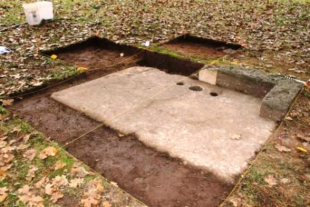 Shrine Perimeter Excavated (City of Salem Facebook) 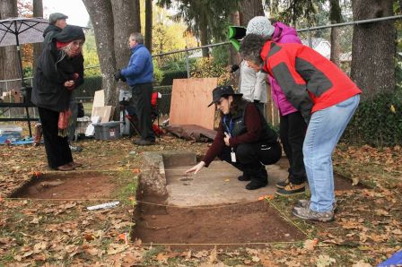 | 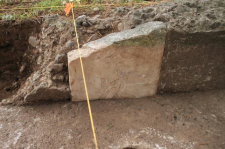 Portion of Engraved Stonework (City of Salem/FB) 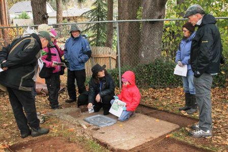 |
Posted by Deb Meaghers


 RSS Feed