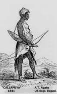
There are many places in the region of Oregon west of the Cascade Mountains named for the indigenous people who lived here before the immigrants arrived. Kalapuya, Callapuya, Calapooia, Kalapooia are just some of the various published spellings for the Native Americans who lived in the oak savanah region between two mountain ranges that we now call the Willamette Valley. The drawing to the left depicting one tribal member was sketched by A. T. Agate of the US Exploratory Expedition in 1841.
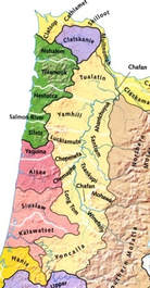 Kalapuya Range (ivory color), Treaty of 1855
 Published documentation on the various bands of Native Americans in Oregon, especially in our area, is relatively scarce. In the map shown at the right, the range of the Kalapuya is designated by the ivory color. In 1856, 27 tribes occupied the Oregon Territory. They were all relocated to the Grand Ronde Reservation. When we were contacted by Ken Ploeser, today's guest, about the research he had gathered in a rather unique manner, we were very excited to learn what he had to share.
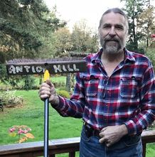 Ken Ploeser, Creek Walk Project, and "Antiok Hill" broom [Photo: KPloeser]
 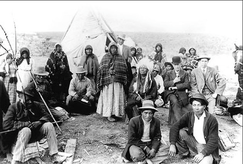 Kalapuyas gathered in Portland area (Photo, PDX.history)
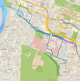
 | Ken's unique manner of research includes walking the creeks of our area and their various branches, beginning at their confluence with the Willamette River and heading "upriver" as far as he can. He documents what he finds by camera, field notes, and GPS marking. He then begins researching the area he has walked on the internet (just "Google" local street/creek names, he says) and by visiting local history archive resources, such as the Willamette Heritage Center. He contacts tribal offices as well as public work agencies. He shared that one of the first creekwalks he undertook was the Pringle Creek tour found on Virginia Green's website SHINE, and he would encourage anyone to begin with this one. |
Recently, the Pringle Creek Watershed Council adopted the Creek Walk Project as a partner. You can learn more on their Facebook Page, Creek Walk Project. Ken would love to help you begin by sharing his creek walks with you and hearing about yours. You can reach him through the Facebook page, by email at [email protected], or by phone at 503-362-0873.


 RSS Feed